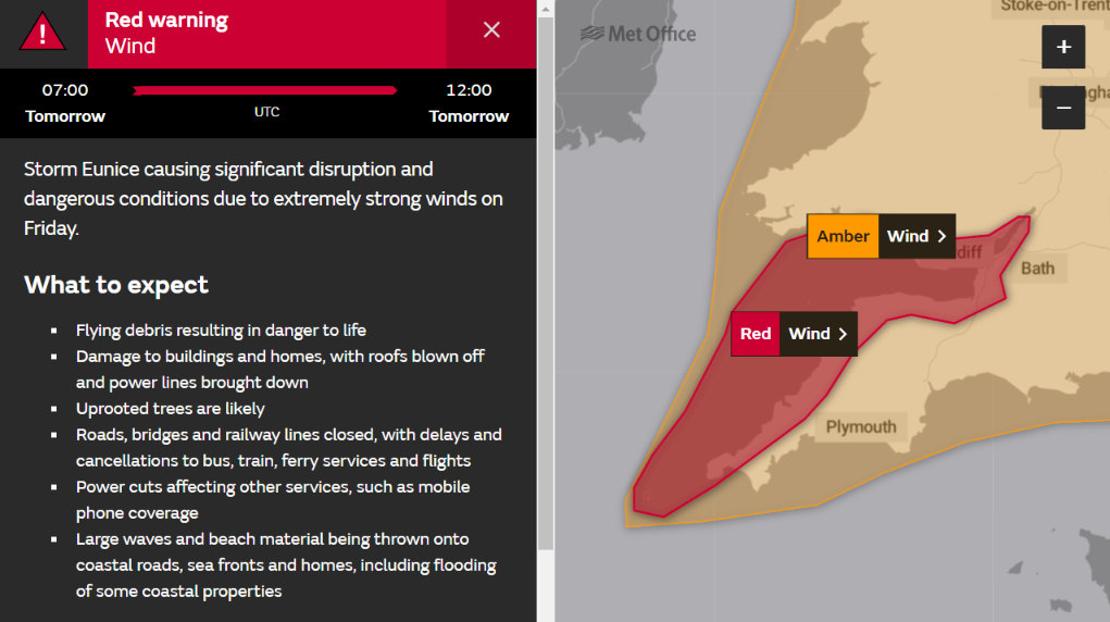
The Met Office have just issued a rare red wind warning for the North Cornwall coast when Storm Eunice arrives tomorrow morning:

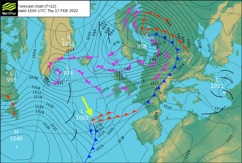
. The storm looks fairly innocuous on the current Met Office synoptic charts:

However Storm Eunice is a “bomb cyclone“, so hurricane force winds are certainly possible in the Davidstow area. The forecast for tomorrow may still change, but the Met Office currently put it this way:
Extremely strong west to southwesterly winds will develop over southwest England and south Wales early on Friday. Widespread inland gusts of 70-80 mph are likely and up to around 90 mph near some coasts, with dangerous conditions on beaches and seafronts. Winds are expected to ease from the west during the late morning.
What to expect
- Flying debris resulting in danger to life
- Damage to buildings and homes, with roofs blown off and power lines brought down
- Uprooted trees are likely
- Roads, bridges and railway lines closed, with delays and cancellations to bus, train, ferry services and flights
- Power cuts affecting other services, such as mobile phone coverage
- Large waves and beach material being thrown onto coastal roads, sea fronts and homes, including flooding of some coastal properties
Storm Eunice has now officially formed out in the North Atlantic, and the 12 PM weather model runs are now available. The GFS mean sea level pressure forecast for tomorrow morning now looks like this:
Continue reading “Met Office Red Wind Warning for Storm Eunice”